The Dictionary of Sydney was archived in 2021.
The Dictionary of Sydney was archived in 2021.
Geology and geography of the Georges River
Citation
Persistent URL for this entry
To cite this entry in text
To cite this entry in a Wikipedia footnote citation
To cite this entry as a Wikipedia External link
Georges River Geology and Geography
[media]In the Georges River catchment there are three main geological layers.
The oldest layer is the Hawkesbury sandstone that forms the rocky, bush covered terrain around much of Sydney and can be seen clearly in the nearby National Parks. This was overlain by Wianamatta shales that are especially present to the north of the Georges River and form the main, relatively flat terrain on which much of Sydney’s suburbs are built. Over time the river cut through the Wianamatta shales as it formed its gorges, and are thus flanked by the Hawkesbury sandstone. In areas that are prone to flooding around Liverpool and along tributaries such as Prospect and Cabramatta Creeks, these shales were in turn overlain by more geologically recent Quaternary sediments.
Following the river
[media]The river originates well to the south of Sydney, with its source in the Cataract Scout Camp, to the south-east of Appin and about 16.4 km inland from Coalcliff on the Illawarra coast. It then flows in a generally north-north-east direction to the present day Chipping Norton Lakes, near Liverpool.
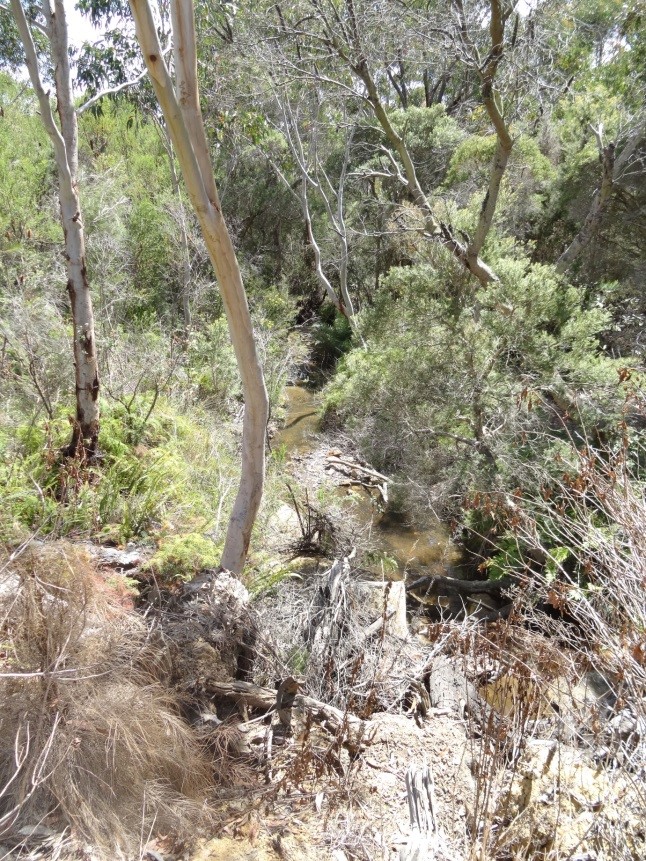
[media]For much of this length it flows in a steep sided valley through Hawkesbury sandstone country[1], with bush on both sides of the river, particularly on its east side at the Holsworthy military reserve. Along these upper reaches the Georges River would often be better described as a creek than a river. Platypuses are still seen occasionally in this stretch of the river[2] and there are koalas in the area[3]. On its western side, built mostly on the softer, more erodible Wianamatta shales, are the south-west suburbs.
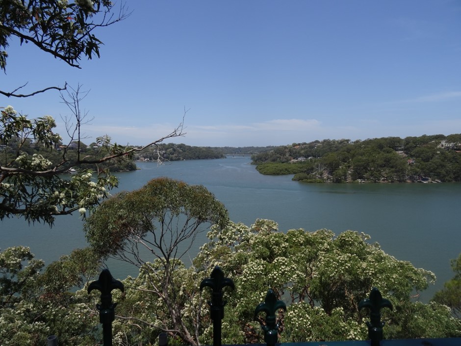
[media]From about Macquarie Fields north to Chipping Norton Lakes, and then south east to about Voyager Point, the river flows across a plane of Quaternary sediment, deposited by floods[4] over many centuries. Beyond Voyager Point the river flows again through Hawkesbury sandstone country and steep sided valleys as far downstream as Tom Uglys Point at Blakehurst, although set back from the river on its northern side are areas of Wianamatta shale.
Suburban Sydney borders these latter stretches of the river right through to Botany Bay.
Human impact
[media]Human activity has had major impacts on the geological nature of the river.
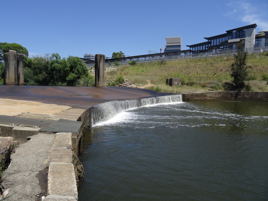
The Liverpool Weir was constructed in 1836 to provide a water supply for Liverpool[5], forming a barrier between fresh and salt water. It also blocked fish from migrating upriver but a fish way was installed in 1997 to allow them to pass[6]. The original weir was built by David Lennox[7] and his work is incorporated into the present weir.
The river was also extensively dredged for sand starting in the 1950, and so is deeper than it once was. The greatest impact of sand mining was around the Chipping Norton area where large quarries were formed[8]. These quarries have been transformed into the Chipping Norton Lakes and become a valuable recreational feature.
Notes
[1] Sydney Metropolitan Catchment Management Authority, Geology Map of the Georges River Catchment, Sydney, 2011. Georges River Combined Councils' Committee website http://www.georgesriver.org.au/GRCCC-Documents.html, viewed 21 October 2015
[2] Platypus, Georges River Environment Education Centre website http://www.georgesrivereec.com.au/index.php/resources/significantfauna/list-of-selected-fauna?id=290, viewed 5 November 2015
[3] Campbelltown Koalas, Planting the Future: Koala Retreat website http://www.koalaretreat.com.au/index.php/campbelltown-koalas.html, viewed 5 November 2015
[4] Sharyn Cullis, Georges River: Flooding the City, Dictionary of Sydney, 2014, http://dictionaryofsydney.org/entry/georges_river_flooding_the_city, viewed 01 January 2015
[5] Liverpool Weir – Statement of Significance, New South Wales Land and Property Information website http://www.baseline.nsw.gov.au/heritage/heritageProperty/12;jsessionid=E5AC8CFB2DAC68FAEB859B350FD772C7?ref=d-5912750-p%3D4%26heritagePropertyName%3D*, viewed 21 October 2015
[6] Liverpool Weir Fishway, Native Fish Australia website https://web.archive.org/web/20150227204254/http://www.nativefish.asn.au/weir.html, viewed 27 August 2015
[7] David Lennox is better known as a bridge builder and one of his bridges, Lansdowne Bridge, is still in use where the Hume Highway crosses Prospect Creek, shortly upstream of its junction with the Georges River. See also: J. M. Antill, 'Lennox, David (1788–1873)', Australian Dictionary of Biography, National Centre of Biography, Australian National University, http://adb.anu.edu.au/biography/lennox-david-2350/text3071, published first in hardcopy 1967, viewed 21 October 2015.
[8] Sharyn Cullis, Sand mining history of the Chipping Norton Lake, Living Streams website https://livingstreamsliverpool.wordpress.com/2012/09/29/sand-mining-history-of-the-chipping-norton-la/, viewed 21 October 2015


